|
Paper Plate Education
"Serving the Universe on a Paper
Plate"
Video Excerpts: Latitude by Polaris
The following pictures and narration are excerpted from the Paper
Plate Astronomy video.
Here we will show how a navigator determines her latitude
from the altitude of Polaris, the North Star.
 As our navigator’s ship travels from the
equator... As our navigator’s ship travels from the
equator...
 ...the altitude of
Polaris above her horizon not only increases, but is congruent with her
latitude. ...the altitude of
Polaris above her horizon not only increases, but is congruent with her
latitude.
 By the time she reaches
90 degrees of latitude... By the time she reaches
90 degrees of latitude...
 ...the altitude of Polaris is likewise 90 degrees. ...the altitude of Polaris is likewise 90 degrees.
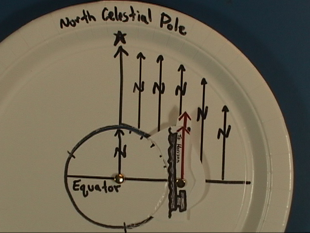
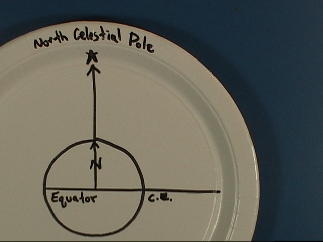
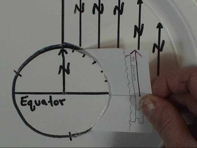
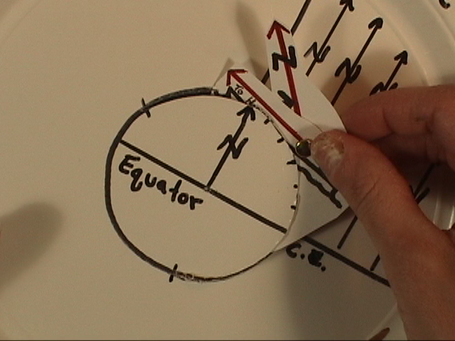
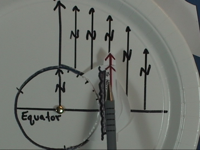
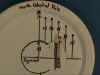
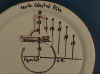
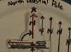
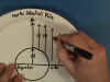
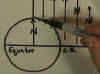
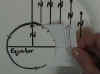
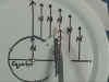
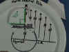
Draw a circle to represent the earth on 10-inch white
plate. Extend the equator out to
the edge, and extend the north pole
out to the edge, too.
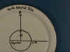 Label these the equator, celestial equator or
C.E. ,
north, and Polaris at the north celestial pole. Label these the equator, celestial equator or
C.E. ,
north, and Polaris at the north celestial pole.
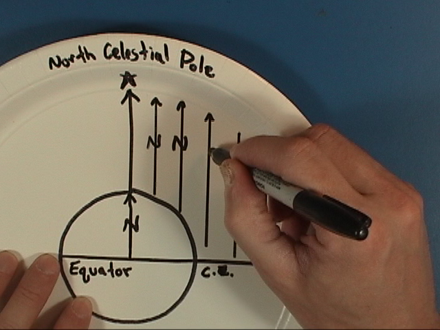
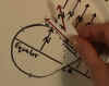
Polaris is so far away that its starlight is coming in
parallel to the north celestial pole.
 Draw
several parallel lines to reinforce this notion.
Looking up any one of these lines of sight, no matter where you are on
the earth will end on the north star. Draw
several parallel lines to reinforce this notion.
Looking up any one of these lines of sight, no matter where you are on
the earth will end on the north star.
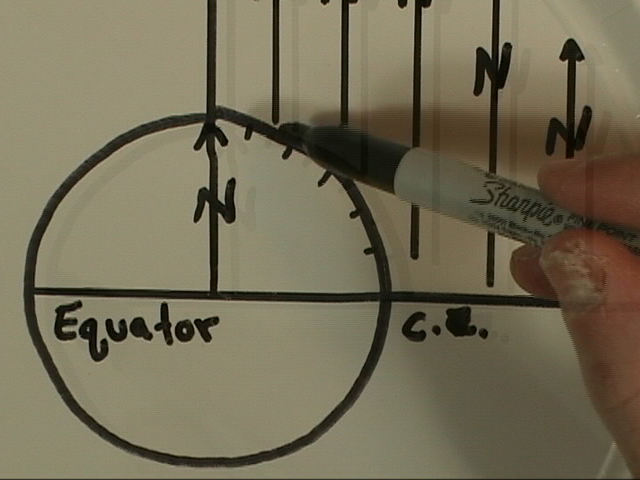
 Use a protractor and label the latitude, shown here in
increments of 15 degrees. Use a protractor and label the latitude, shown here in
increments of 15 degrees.
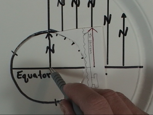
From about this part of the earth...to about here, cut a
slit along the perimeter of the earth.
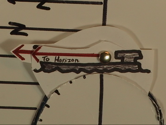
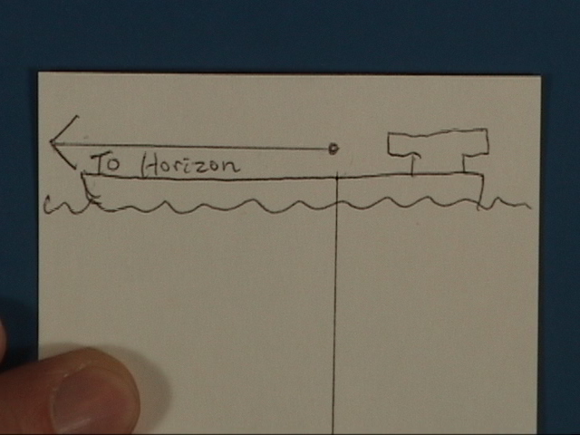
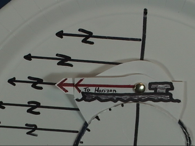
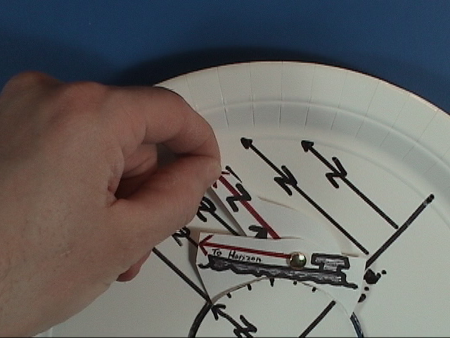
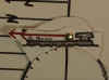
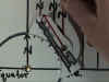
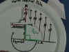
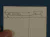 Mark a 3 by 5 card as shown... Draw some water with a ship
on it... [This is the direction our navigator would look toward the horizon, so
] label the red arrow “To Horizon”. This
the direction to our navigator’s horizon, up from which she measures the
altitude of the stars. Mark a 3 by 5 card as shown... Draw some water with a ship
on it... [This is the direction our navigator would look toward the horizon, so
] label the red arrow “To Horizon”. This
the direction to our navigator’s horizon, up from which she measures the
altitude of the stars.
 Slip the card under the slit on the plate so the waterline
is on the edge of the earth. Slip the card under the slit on the plate so the waterline
is on the edge of the earth.
 With
the vertical line visible at the earth’s center, mark the card. With
the vertical line visible at the earth’s center, mark the card.
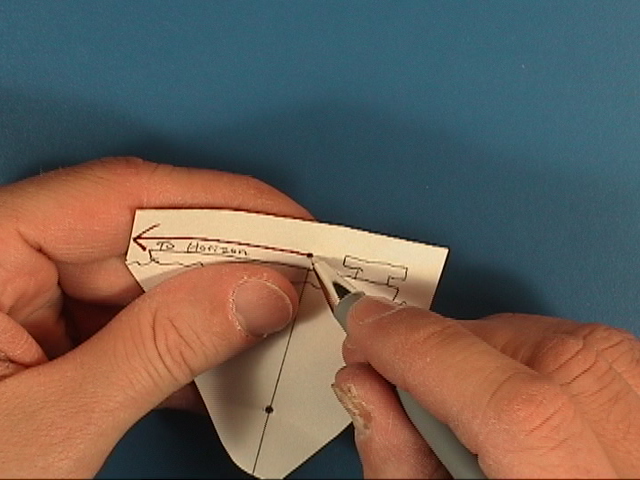
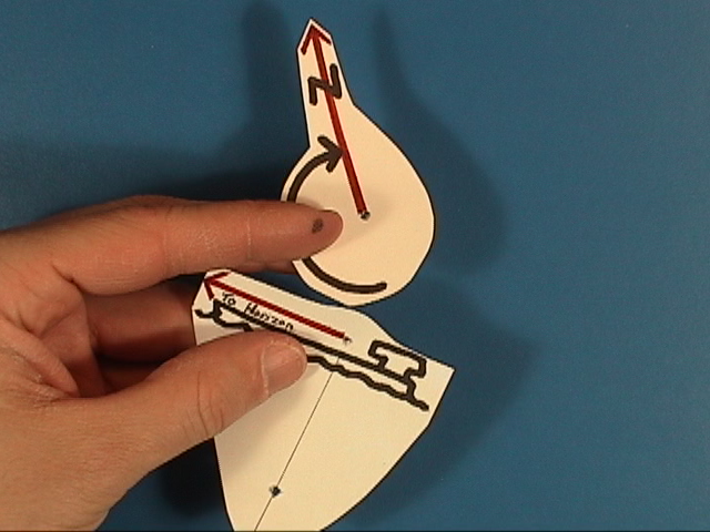
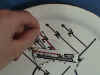
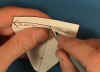 Cut out around the ship and punch out the two holes, as
shown. Cut out around the ship and punch out the two holes, as
shown.
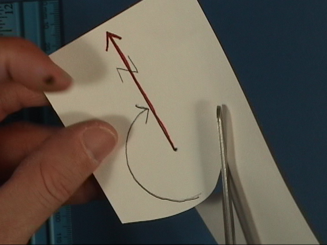
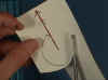 On a second 3 by 5 card, draw a red arrow and label it
North. Swing an arc...punch a
hole... and cut it out as shown. On a second 3 by 5 card, draw a red arrow and label it
North. Swing an arc...punch a
hole... and cut it out as shown.
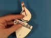
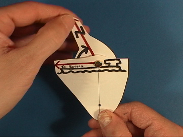
 Fasten the arrow cutout to the ship cutout at the 90
degree bend.
Fasten the arrow cutout to the ship cutout at the 90
degree bend.
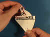
 And then affix the hole rig to the plate. And then affix the hole rig to the plate.
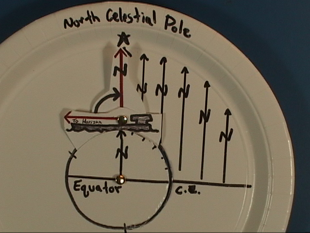
Using the Latitude
by Polaris
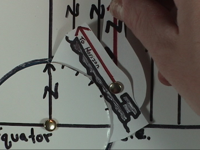
 If our ship begins a journey north at the equator, the
navigator looks this way to see starlight from Polaris coming in tangent to the
equator. If our ship begins a journey north at the equator, the
navigator looks this way to see starlight from Polaris coming in tangent to the
equator.
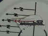 From the perspective of
the ship, the direction the North Star is straight ahead toward the northern
horizon. The altitude of Polaris is
zero degrees. From the perspective of
the ship, the direction the North Star is straight ahead toward the northern
horizon. The altitude of Polaris is
zero degrees.
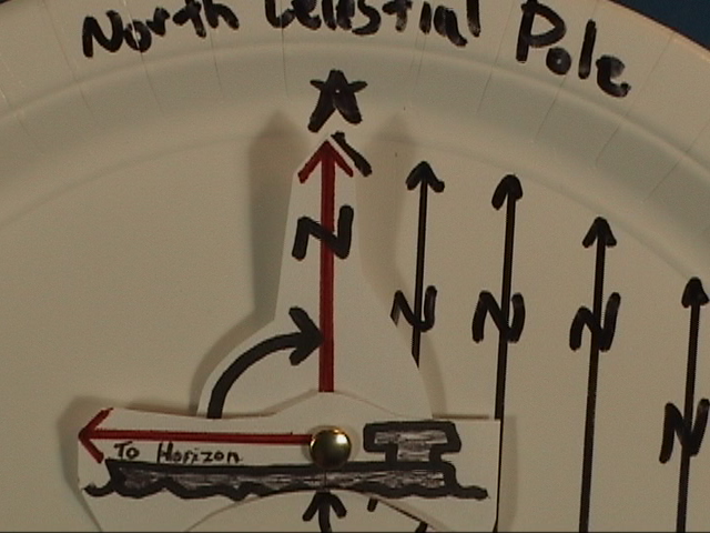
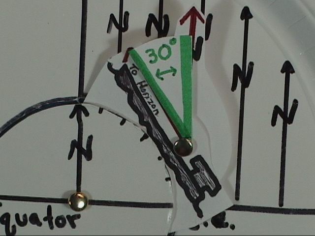
 As it travels
north... As it travels
north...
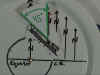
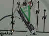 ...the angle between the horizon and
Polaris, the altitude, is 30 degrees... ...the angle between the horizon and
Polaris, the altitude, is 30 degrees...
 At
the same time, the angle from the equator to the ship’s position, the
latitude, is also 30 degrees.
At
the same time, the angle from the equator to the ship’s position, the
latitude, is also 30 degrees.
The ship moves north.
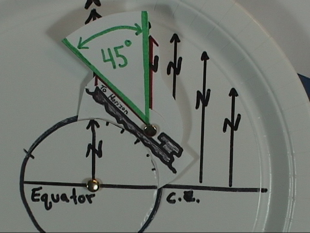
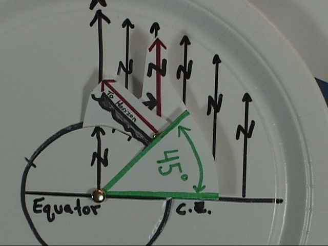
 When the altitude of Polaris is 45 degrees, the ship’s
latitude... When the altitude of Polaris is 45 degrees, the ship’s
latitude...
 ...is
also 45 degrees. ...is
also 45 degrees.
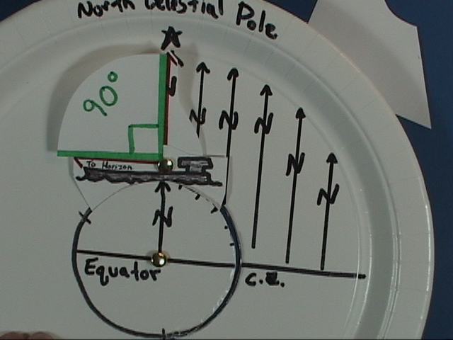
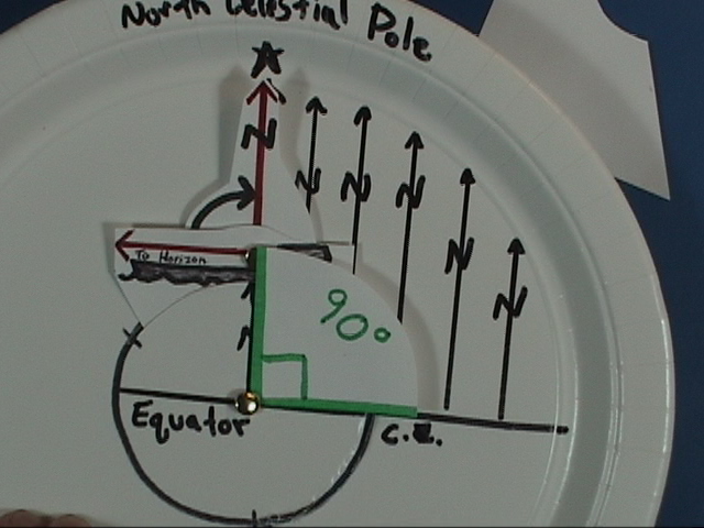
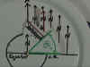
 By the time the ship reaches the north pole, the pole star
is directly overhead --altitude equals 90 degrees... By the time the ship reaches the north pole, the pole star
is directly overhead --altitude equals 90 degrees...
 At the pole, the latitude is 90 degrees. At the pole, the latitude is 90 degrees.
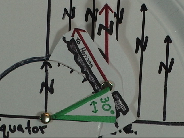
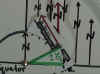
 For a different perspective you can focus in on the ship
to see the angular height of Polaris rising congruent with angle of
latitude. For a different perspective you can focus in on the ship
to see the angular height of Polaris rising congruent with angle of
latitude.
|